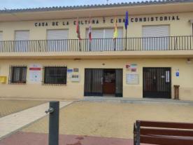
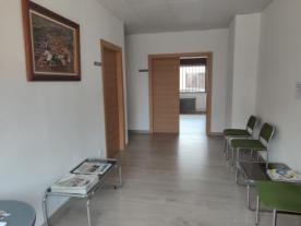
Ayuntamiento de Manganeses de la Lampreana
Type: Ayuntamiento
Locality: Manganeses de la Lampreana (Zamora)
Path and stage:
- Vía de la Plata desde Sevilla / Zamora-Granja de Moreruela
Address: Plaza del Ayuntamiento, 1
Coordinates: 41.750694, -5.711901
Distance to the nearest axis of the path: 4.7 km
Town Hall of Manganeses de la Lampreana and the hamlet of Riego del Camino.
Municipal and tourist information about all the districts of the municipality of Manganeses de la Lampreana and the municipal swimming pool.
The municipality of Manganeses de la Lampreana is an area of environmental interest within the Natural Reserve ‘Lagunas de Villafáfila’.
Open from Monday to Friday from 9:00 to 14:00, information at the Secretary's Office.
Contact
Fixed: +34980588114
E-mail: aytomangalam@hotmail.es
Closing days
Closed: Saturday, Sunday
Services
Accessible reduced mobility: YES

 Printing...
