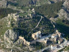
Castillo de Moclín
- Camino Mozárabe desde Almería / Pinos Puente-Moclín
- Camino Mozárabe desde Almería / Moclín-Alcalá la Real
Moclín Castle was built in the mid-13th century for the defence of the Nasrid Kingdom of Granada. Also called Hins Al-Muqlin (fortress of the two pupils), it emerged as a border castle between the kingdoms of Granada and Castile and was continuously besieged during the Spanish-Muslim settlement, falling into the hands of the Catholic Monarchs in 1486. It has direct links with the Fortaleza de la Mota in Alcalá la Real and with the Alhambra in Granada.
It has an irregular ground plan, adapting to the terrain, and alternating cylindrical and rectangular towers. It stands on the highest peak in the area, more than a thousand metres above sea level. Two distinct areas stand out:
The first is made up of the outer walls, which reach their greatest slenderness towards the west and south, decreasing as one moves towards the Tajos de la Hoz. At some points, the rock itself performs defensive functions.
The second part of the castle, the citadel, was reached by the Camino Real, which still exists today. The Torre del Homenaje (keep), the tallest of them all, stands out at the entrance gate. It is located in the northeast corner of the castle, overlooking the lands of Alcalá la Real. Inside the citadel, in the upper part of the castle, there is also a large cistern, which is of great importance in the event of a siege.
In 1931 it was declared a historic-artistic monument and is an Asset of Cultural Interest with the category of Monument.
At present, given its period of research, it is undergoing a period of research, intervention and restoration.

 Printing...
