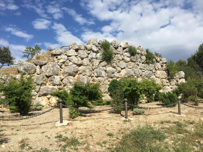
Muralla Ciclópea del Cerro Miguelico
Heritage cataloging: Lugar Arqueológico
Locality: Torre del Campo (Jaén)
Path and stage:
- Camino Mozárabe desde Jaén / Jaén-Martos
Address: Carretera de Santa Ana.
Coordinates: 37.7601837, -3.9017632
Distance to the center of the population: 0 km
 Printing...
The Mozarabic Way as it passes through Torredelcampo gives us the opportunity to contemplate the Cyclopean Wall of Cerro Miguelico. A section of wall 4 to 6 meters high, in the western and southern sectors of the site, possibly from the 1st century after Christ. In the vicinity of the Wall there is a Visigothic necropolis.
Contact
Fixed: +34953568649
Closing days
Closed: Does not close
Services
Accessible reduced mobility: YES
Pets allowed: YES
Visits
Free: YES
Gallery
